
DedroneTracker.AI
Multi-sensor C2 software platform that fuses RF, radar, video and acoustic feeds into a single AI-driven airspace operations picture with autonomous drone and pilot geolocation.
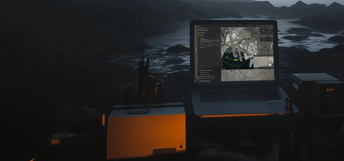
DedroneTracker.AI is Dedrone's command-and-control software layer — the intelligence core that turns a field-deployed mix of sensors into an integrated counter-UAS system. At its foundation it ingests simultaneous streams from RF sensors, radar, PTZ and thermal cameras, and acoustic arrays, applies sensor fusion, and maintains a continuously ranked threat queue that allows a single operator to manage large, complex airspace. Autonomous background interrogation means the system classifies and re-interrogates every detected signature without waiting for operator input, surfacing drone type, drone location, and remote-pilot location on a georeferenced map in near-real time.
The platform's AI engine, built around the Pythagoras 1 vision model trained on NVIDIA H100 hardware with more than seven years of accumulated flight data and 2 million newly annotated images, delivers 24.3 percent higher mean average precision than its predecessor and a 14× improvement in detecting extremely small UAS — the category that defeats older detection pipelines. False-positive rates are near zero across certified test events, and the system consistently achieves 95 percent accuracy at authoritative Counter-sUAS evaluation events, with direction-finding accuracy within 2.5 degrees.
For airport and critical-infrastructure operators, the Version 6.0 Defeat Manager integrates directly with authorised jamming and cyber-defeat hardware, closing the kill chain within the same operator interface. A library of nearly 300 identified drone models allows confident identification rather than generic anomaly flags. Remote ID standards from the US, EU, and Japan are supported natively. Certifications include US DHS Safety Act Designation, SAPIENT compliance, and Veracode software-security verification — the set most frequently required in government and airport procurement frameworks. In the GCC, where airport perimeter threats from consumer and commercial UAS are a documented concern at major hubs, the platform's scalable deployment (DedroneCity, DedroneFixedSite, DedroneTrailer+, and DedronePortable form factors) allows an operator to right-size coverage from a single terminal to an entire airfield.
Technical specifications.
| Drone identification database | ~300 models |
| Direction-finding accuracy | ≤2.5 degrees |
| C-sUAS test-event accuracy | 95 % |
| Vision-model mAP improvement (Pythagoras 1) | +24.3 % |
| Small-drone detection improvement | 14× |
| Sensor inputs supported | RF, radar, video, acoustic |
| Certified partner integrations | 20+ |
| Standards compliance | Remote ID (US / EU / JP); SAPIENT |
| Security certifications | US DHS Safety Act; Veracode; CPNI-rated |
Use cases.
- ›Airport perimeter and runway-approach airspace monitoring at commercial and military airports
- ›Fixed critical-infrastructure protection (power generation, desalination, data centres)
- ›Military and government C-sUAS system-of-systems integration as single-pane-of-glass C2
- ›Mobile and rapid-deployment operations (stadium events, VIP movements, convoy protection)
- ›Forensic evidence collection: timestamped flight history, operator location, and video for enforcement or prosecution
Replacements & compatible alternatives.
Comparable Counter-UAS & Base Air Defence from other suppliers. Cross-shop on specs — confirm exact fit and compatibility with the supplier before specifying.