
SkyDome Manager
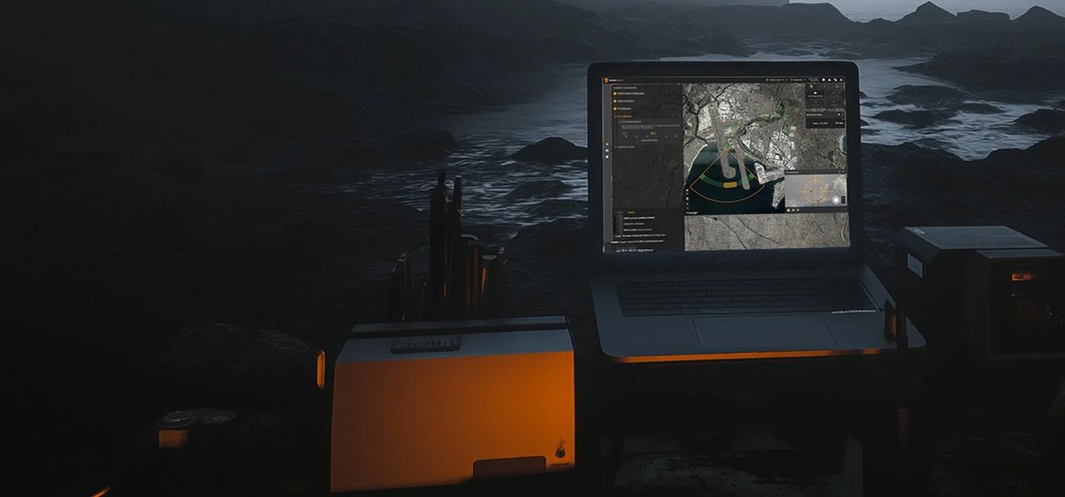
Unified counter-UAS command-and-control software that fuses radar, camera, and RF sensor feeds into a single 3D airspace operating picture.
SkyDome Manager is Fortem Technologies' purpose-built airspace monitoring and C2 software platform — the software backbone of the SkyDome counter-UAS system. It ingests live tracks from TrueView radars, TrueView C30 cameras, RF sensors, and third-party sensors via a standardised API, correlating them into one continuously updated 3D map. The platform's ThreatAware AI engine classifies every tracked object, evaluates its payload-carrying capacity, and assesses intent from distance, heading, and closing speed, generating a risk score that can trigger pre-configured automated responses without operator input.
For procurement engineers evaluating a C-UAS installation, SkyDome Manager removes the single most common failure mode: multi-vendor sensor stacks that don't share a common track picture. Its configurable automation engine lets operators define spatial exclusion zones — roads, pedestrian areas, known bird corridors — to suppress false alarms, and set per-zone rule chains that can simultaneously alert security personnel, activate warning lights and sirens, and vector a DroneHunter interceptor to an assigned drop zone. The system can run as the primary C2 or as a sub-system feeding an existing command infrastructure over REST, real-time, or track-only APIs with more than a hundred addressable fields.
SkyDome Manager has been operationally validated at large-scale public events — including the 2022 FIFA World Cup in Qatar — where persistent monitoring, automated threat response, and evidence collection ran concurrently without disrupting venue operations. Airports, military installations, energy infrastructure, and public-venue operators in the GCC and wider Middle East face compound airspace threats (commercial UAS intrusion, improvised payloads) that demand exactly this kind of always-on, low-operator-burden posture.
Technical specifications.
| Sensor integration | TrueView R20/R30/R40 radars, TrueView C30 camera, RF sensors, third-party sensors via open API |
| AI threat assessment | ThreatAware engine — classifies object type, payload capacity, intent from kinematics |
| Exclusion zone filtering | 3D configurable zones by size, speed, altitude, classification |
| C2 API | REST, real-time, and track-only APIs; 100+ addressable fields and commands |
| DroneHunter mission modes | Pursue, Attack, Defend, Auto-Capture, Go-To Location |
| Integration | US Army FAAD C2 and major defence-contractor C2 systems |
| Automation | Highly configurable rule engine; autonomous or human-on-the-loop authorization |
| Evidence | Automatic correlation of video evidence with track history for post-incident review |
Use cases.
- ›Persistent airspace monitoring at international airports and perimeter-controlled airfields
- ›Multi-sensor fusion for large-scale public events (stadiums, state ceremonies, major gatherings)
- ›Autonomous or semi-autonomous kinetic response co-ordination using DroneHunter interceptors
- ›Integration layer feeding an existing military or government C2 architecture
- ›Critical-infrastructure protection (energy plants, refineries, desalination facilities) in the GCC
- ›Post-incident evidence packaging for law-enforcement and regulatory reporting
Replacements & compatible alternatives.
Comparable Counter-UAS & Base Air Defence from other suppliers. Cross-shop on specs — confirm exact fit and compatibility with the supplier before specifying.